Click here for: 2013 WA-BC-Alaska Photo Gallery
Fall 2012- Spring 2013: SAN JUAN ISLAND, WA USA
We enjoyed several short trips around the San Juan Islands of Washington. With the boat moored in Anacortes, it was easy to get away – one of favorite get-a-ways became Strawberry Bay (48:33.71N/122:43.67W) in Cypress Island which was just around the corner. Orcas Island is beautiful, although very populated and devloped, we enjoyed anchoring in Deer Harbor (48:37.04N/123:00/27W). We enjoyed spending time with our family both on and off the boat.
April 22, 2013
(48-36.99N /123-00.11W)
Lopez Island Mackay Harbor (San Juan Islands, WA)
We just returned from a daytrip sailing around the southeast side of Lopez Island with Lexi and Kirm – even spied on Paul Allen’s gorgeous estate:)
WASHINGTON to ALASKA, Summer Season 2013
May 1, 2013
(48-40.26N /123-11.19W)
Stuart Island, San Juan Islands, WA; Beautiful, sunny day!!

 May 2, 2013
(48-45.78N/122-54.22W)
Sucia Island, WA
This is a great spot, accessible only by private boat and maintained by the Blaine Yacht Club. The island is covered with hiking/running trails, lovely beaches and picnic areas, no cars – only boats!
May 3, 2013
(48-59.54N/122-45.66W)
Blaine Harbor to pick up Jodie!!
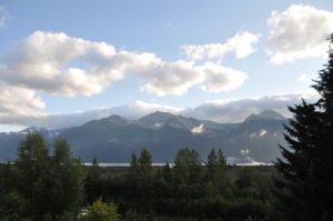
 It’s a gorgeous sunny morning with promises of more days like this to come:) We are looking forward to having Jodie on board again and will do our best to make it a relaxing and fun trip for her. As an Emergency Medicine Resident at UW in Seattle, she as been smashingly busy and overworked. She’s been instructed to come ready to chill out and take in the soporific motion of the boat while gazing out over Mt Baker, the Cascades and even the Olympic Peninsula serenaded by screeching seagulls!
 May 4, 2013
(48-45.73N/122-54.23W)
Sucia Islands with Jodie:) Dropped anchor with the sunset! Had to use my headlamp to see what I was doing. Happy Hour, wine dinner, sleep… Cheers!
 Looking forward to some great time with Jodie for a couple of days.

BRITISH COLUMBIA – Cruising up the Inland Waterways of B.C.- Canada
 May 6, 2013
(48-53.39N/123-23.67W)
Montague Harbor, BC Canada – another beautiful, warm day!!
We’re in the eastern area of Vancouver Islands rather than up around the city of Vancouver – much prettier:) Another lovely day here, perfect except for NO JODIE ON BOARD. We’re anchored in a lovely bay -Checked into Canada via satellite phone (amazingly efficient and easy system they have) and enjoying a happy hour/sunset out on the deck.
 May 7, 2013
(49-43.50N/ 124-10.32W)
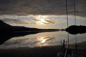
Blind Bay -great sunset and calm waters
We had a relaxing start today and made about 68 miles north to anchor under bright sunny skies in Blind Bay. Took us multiple attempts to get the anchor set due to the the smooth rocky bottom. It’s an incredibly calm and beautiful night with a late sunset (9pm) after a day of super sunny skies. We couldn’t ask for better weather, although a bit more wind would make Captain John happy. Managed a a bit of motor sailing and with the currents in our favor for most of the day, our time was good (minus a deviation for the Canadian military training exercises??) Tomorrow we’ll work to time our passage of Seymour Narrows to match the tides/currents. It’s a fun and very fast passage if you get it right but weird to calculate because the currents at either end seem to go the other direction – very bazaar- but we got it right last year and will hope to do the same this time around although with the time of day, we’ll need to anchor overnight in one of the protected coves in the middle of the long passage. Last year we were able to start really early and just keep going for the full 86+ miles.
May 8, 2013
(49-43.88N/ 124-17.72W)Speed: 7.0; Course: 289T
Sailing toward Seymour Narrows
Another lovely sunny day in BC:) Woke to a glassy calm morning, absolutely quiet, almost hauntingly so, and took off after a leisurely coffee. We’ll try to catch the tides up the Narrows and beyond a bit, then overnight and catch the tide again about 5am.
May 8, 2013
50-21.08N/ 125-27.96W
Turn Island for the night to make an early start
For now we are keeping a pretty quick pace, and it’s very pleasant because of the fantastic weather!! Really amazing weather and the vistas are even better this year with the various snow capped peaks on the horizons – definitely more dramatic. After calculating, discussing, analyzing and arguing…we hit the Seymour Narrows at exactly the right time, and yet the tides and currents were very disappointing. Nothing dramatic, just slack tide at Ripple Rock which is safe and easy, but alas no real spikes in speed. Last year we topped at 13.5kts through that area..this year we headed into a current that brought us back to 1.3max kts (nearly going backwards) and then were rewarded with nothing better than 10. We’re set to rise at 6am and try to catch the currents in the morning, take a break and then catch them again for the evening.
 May 9, 2013
50-25.97N/ 126-00.19W; Speed: 10.0; 302T
Passing Johnson Strait – have hit 12.8kts!
We started out at 6am in order to catch the tides in our favor and managed to get up to a speed of 12.8kts!! Mostly average 8-9, so made good progress until the turn of the tide and reversing of the currents, so we chose to find an anchorage and wait it out for a few hours. I’ve mixed up another batch of sourdough bread (a single batch this time!!?) and we’ve already put on the pot of tea. We’re looking at our options for a 4 hr passage with the next favorable tide. Not sure if we’ll go the inside routes up Northern BC or head out into Queen Charlotte Sound and make an overnight. The sun is obscured by thick low clouds so we can no longer enjoy the lovely vistas of snow covered peaks, but at least it isn’t raining yet. That’s in the forecast as a low passes through over the next few days.
May 10, 2013
50-35.96N/126-40.59W
Berry Island – BC
After a rather dramatic and shortened crossing yesterday evening, we escaped into a very calm and protected little bay waking up this morning to clouds down nearly at water level. It’s one of those misty mornings and we’re just relaxing over coffee – a nice reprieve from yesterday’s brief and unexpected slamming.
May 10, 2013
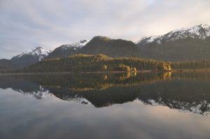
Anchored (50-50.31N /126-55.49W)
Dickson Island inside Popplewell Point. Beautiful Vista at sunset.
 We awoke this morning in our quiet little bay to find the clouds down on the water around us, so it looks like a good morning for another pot of coffee/tea, a bit of reading and maybe even a little local exploration in the dingy?? A funny contrast to our evening passage into 27kt winds with wind against tide – not fun and totally unexpected! We decided to shorten our trip and take refuge back behind the islands. I made more sourdough yesterday – it didn’t want to rise but eventually the two small baguette type loaves actually grew a bit and I threw them in the oven while making dinner only to forget I’d done that and turned off the gas before they were finished- argh!! Heated it up again and they are ok, sort of, but would have actually been great if I’d paid them more attention and set a timer.
May 11, 2013
(51-28.46N /127-44.44W
Secure Anchorage at Penrose Island sheltered by Bird and Ironside Islands
 May 12, 2013
Latitude: 52-04.48N/ Longitude: 127-51.72W
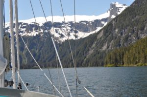
Codville Lagoon Nature/Marine Reserve near Bella Bella – misty beauty
Kris and I are making our way north in the boat towards Sitka. Right now we are in a salt lake that you can enter at high tide. We are waiting out a storm that is blowing 45 knots out in the gulf but we are snug in out lovely boat with the heater running and drinking hot chocolate and rum. We both have our slippers on and Kris is reading a serialized book called Game of Thrones by George RR Martin.
So we watched the gribs while calmly snuggled in our anchorage and just as predicted the winds slammed in at about 3am. Made for a short night as we were anchored at the end of the fetch in this lovely lagoon, which was fine in terms of water/waves, however, we did get more wind here and also were made to swing toward the rising shore at the head of the bay. Another boat had been in the more protected anchorage and there was not room for two to anchor and swing there. This had us both a bit anxious, especially in the black of night. Fortunately the anchor was well snagged and the boat was able to swing around and keep sufficient waters underneath us, nonetheless, John stayed up and did an anchor watch until about 5am when there was plenty of light and he was satisfied that we were fine. Now we’re off soon to make our way into Bella Bella.
May 13, 2013
Latitude: 52-08.71N /Longitude: 128-04.57W
Shearwater for Mother’s Day
I thoroughly enjoyed being spoiled with a dinner out (after an easy trip up the inside waters courtesy of Captain John giving in to my requests to PLEASE stay out of the offshore gales even though they would have meant brisk sailing as opposed to motoring.) As always, he views 25-35kt winds as a chance for a fast sailing trip, whereas, I think of the cold, the huge waves and heeled over bouncing boat…to my dishonor, I’m not so brave and eager as I used to be. As you know, such winds in the PacNW are rough.
We’ll confer over our 2nd cup of coffee this morning and decide how the next few days will be traveled.
May 14, 2013
Latitude: 52-56.64N/Longitude: 129-08.67W
Surf Inlet – Princess Royal Island. At anchor, watched by an eagle
We had a bit of a late start this morning even though we woke up at 6:30am, John did some work on the transfer pump for our diesel tanks and I languished in bed with my Nook and coffee:) Lifting anchor from Shearwater at 9:30, we had an easy ride until hitting the open waters – no great winds- although we tried and managed to motorsail for a few hours, but really lumpy, rolling seas – not our favorite state. Nothing is more annoying than suffering all of the rock and roll while burning diesel! Fortunately we were rewarded with an unexpected current in our favor and that together with the rolling seas that were eventually behind us – let us surf up the channel making 7-8 kts:) Now we are anchored in a lovely, tranquil bay for the night. I DO like these day passages and sleeping at anchor by night. I immediately showered and put on my polar fleece “Squids” before finishing with cooking dinner, so when John appeared in his flannels and furry slippers, the table was ready – lemon chicken and broccoli on brown rice – not bad for wilderness eating. It’s been a funny day of solitude with only one small sailboat at the start of the trip and a distant tug. Almost creepy to see so few boats/vessels in motion. Our AIS system will pick up traffic from up to 35+miles away, so we are in fact all alone.
Captain John is finishing up with the dishes, the generator is making fresh water and we’re soon off to zzzzzz for another passage day tomorrow. We’ll be in the famous Grenville Channel tomorrow. I really hope that the clouds lift enough for us to truly appreciate the grander and beauty.
May 14, 2013 -continued
Latitude: 53-08.06N/Longitude: 129-20.81W;Speed: 7.6;Course: 353T
Heading up to Grenville Channel
May 14, 2013- continued
LATITUDE: 53-33.56N/LONGITUDE: 129-34.22W
Nettie Basin and Verney Falls of Lowe Inlet beautiful valley – soaking wet!!
May 15, 2013
LATITUDE: 53-51.71N/LONGITUDE: 130-01.63W
Cameleon Inlet Anchorage
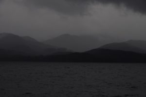
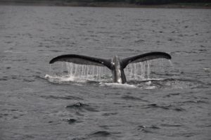
We have had a very long day, very scenic at times with towering mountains gushing waterfalls pouring down from snowy peaks through craggy dark cliffs, a few whales flapping and breaching and even one distant bear; but also lots of rain and low clouds which frustratingly obscured our views!?! The outside water area weather is still gale force 30-40kts, so it’s nice to be on the inside for most of the passage. While the currents were with us, we kept going and after 12 hrs., have nearly cruised the full length of the Grenville Channel. It’s still pretty quiet with just ourselves, a couple of other sailboats and one pleasure craft, no cruise ships or ferries today. Funny enough, this particular anchorage we are sharing with a fishing boat after having already given up on a better anchorage which was already taken by another sailboat who was straddling the best anchoring areas…grr. So few boats and yet three of us are in this one inlet! Only 119 miles to Ketchikan – could do an overnight trip or two long days…..not sure yet what we’ll decide. After checking into the USA, we’ll make our way to Misty Fjords.
ALASKA – USA
May 16, 2013
LATITUDE: 55-21.03N/LONGITUDE: 131-41.06W
Bar Harbor Dock Ketchikan
May 17, 2013
LATITUDE: 55-17.91N/LONGITUDE: 131-28.32W
On buoy in a bay south of Ketchikan
 May 18, 2013
LATITUDE: 55-14.13N/LONGITUDE: 131-25.48W
COURSE: 116T;SPEED: 6.1
On route to Misty Fjords – wet, windy, currents against us!
 May 18, 2013
LATITUDE: 55-31.66N/LONGITUDE: 130-46.92W
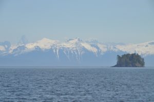
On a Buoy in Misty Fjords Punchbowl Cove. Sureal !
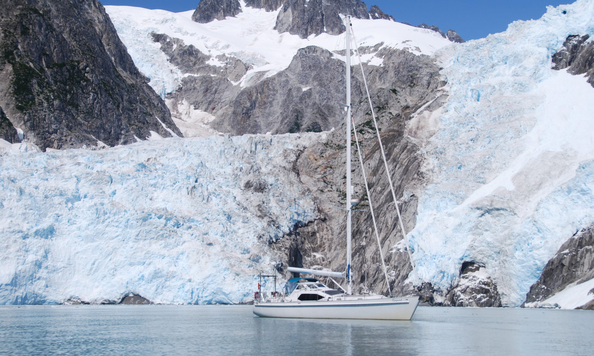
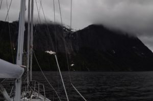
After much ado, we are swinging from a buoy in the magnificent Misty Fjord, Punch Bowl Bay. Ketchikan was a mess of rain, winds and fog, but once we rounded the corner everything improved. We had thought to anchor at an inlet next to Behm Canal, but as the squalls followed us up the bay and the current came in our favor to give us good speed, we decided to risk the extra 12 miles and hope that the buoy was vacant. It’s truly stunning here and we are ALL ALONE!! 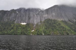 It’s really amazing with the cliffs of Black Mtn climbing straight out of the bay up to 3010ft with cascading waterfalls, eagles soaring around and so many other interesting birds. No bears yet. I think that we will set our alarms to wake up at 5am and go hiking up to the lakes and try to take in all of the enjoyment that we can before all of the cruise ship traffic arrives. We might just wander about the various fjords and then come back here and hope that the buoy it once again vacant for tomorrow night. It really is a special place.
 May 19, 2013
LATITUDE: 55-41.48N/LONGITUDE: 130-54.93W
Entering Walker Bay – Sunny!
![]() May 20, 2013
May 20, 2013
LATITUDE: 55-58.90N/LONGITUDE: 131-10.90W
Fitzgibon Cove – at anchor for the night. Flat calm
We’ve had a full day and are still going up the canal toward tonight’s anchorage in Fitzgibbons Bay.
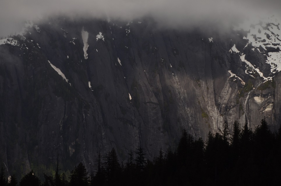
We started early, after enjoying our coffee while looking at the incredible Punchbowl cliffs, 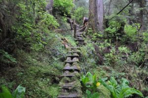 with a steep hike up the hillside to get a great view over some of the torrential, cascading falls in the Punch Bowl.
  We’d hoped to hike all the way up to the lake, above the cliffs, but there had been several landslides and the last part was so steep and torn up, we decided it wasn’t safe to continue on. After some tea and rest, we dropped the mooring buoy about 1pm and made our way to Walker Cove, an incredible narrow fjord with steep 3-5,000ft cliffs literally rising straight up out of the water!
It was hard to take it all in no matter how much we craned our necks! 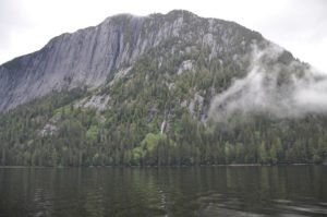 John got some good photos, never the same, but still really nice. AND the sun came out a bit for us, the clouds lifted enough so we could see many of the mountain/cliff tops – it was magical.
 May 21, 2013 LATITUDE: 55-42.51N/LONGITUDE: 132-28.65W Snug Cove after 30 knot winds crossing Clarence Straight
As it turned out those winds that started up just after we emerged from the calms into Clarence Strait just continued to intensify and we ended up with a crashing 25 mile trip up to our current anchorage! Funny how we were so becalmed on the other side, delayed by acoustic testing being done by the military where they made us turn off our engines for 10 mins at a time over what turned out to be 5-6 episodes and either sail or bobb around depending on the winds – so what should have taken only about 2 hours ended up taking about 4 hours – making us late getting around the point and heading up Clarence Strait. Thus, we missed our window of calmer weather. We knew these winds were on their way and had hoped to beat them, however, we are at least in a very Snug Anchorage and one thing about north winds, they bring beautiful sunny skies:) I had hoped to explore around Prince of Wales Island, but with these winds it’s unlikely. We both wish we were in Misty Fjords on such a day – that would have been amazing!! Not sure when or how far we’ll move on today. We’re nestled in for now in a small snug cove on Prince of Wales Island (my old teaching area from 1980-82). The winds are supposed to lessen this afternoon, but we’ll likely take off this morning….Captain John gets restless.
May 22, 2013
LATITUDE: 56-10.42N/LONGITUDE: 132-08.33W
Thoms Place after sail across Chatham Strait up toward Petersberg!
We woke up to a spectacular sunny day and the skies have been clear and bright throughout, such beauty comes at a price of strong northerly winds. Our day started with a boisterous trip across Chatham Strait with 25-30kt gusting winds and rather sharp rolling seas. We tried first to go up the west coast of Prince of Wales from Thorne Bay toward Whale Pass, but gave it up after 45mins of bashing into the waves and shipping tons of water. Totally changing our itinerary, we turned off and were able to sail across at 7.8kts and after 2 hours were finally out of the busting choppy roll of Chatham, still had some gusty winds, but no seas so were able to sail for another few hours although with the irregular winds John ended up at the helm for the last 2 hrs while we tried to point up hard on the wind. The scenery has been really lovely with lots of islets and distant snow covered peaks. Now we are anchored in a lovely wide cove called Thoms Place. It’s not as protected from the wind as we’d hoped, but good enough. Tomorrow we will head up Zimovia Strait, across part of Sumner Strait and then up through the famous Wrangell Narrows to Petersburg. We may need to divide that trip into two days, just depends on our speeds and ability to time the tides and currents.
 May 23, 2013
LATITUDE: 56-32.50N/LONGITUDE: 132-59.06W
Temporarily Anchored Deception Point Cove waiting Wrangell Narrows AM tides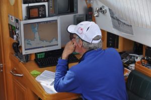
We are anchored early this evening in a small windy cove at the foot of Wrangell Narrow waiting for the AM tides and currents to make our transit through to Petersburg. Oddly today, no matter which direction we traveled (and we did about 360 degrees of different courses) we had the wind on our nose and not a chance for any sailing. Mostly though it was pretty calm and very beautiful with clear blue skies decorated with whispy horsetail clouds and stunning vistas of snow capped peaks rising above the green islands. We feel very lucky to be enjoying this passage with such great weather -even if the winds don’t cooperate. Not the most restful anchorage with 20-27kt winds, but the anchor is well set.
 May 23, 2013- continued
LATITUDE: 56-48.79N/LONGITUDE: 132-57.65W
Petersburg North dock -C36!! Sunny, clear day:)
It’s fun to re-visit Petersburg as I haven’t been here since the kids years on the swim team – even then most of my time was spent working on deck at the pool! We met up with Sandy Hasbrouck and her daughter Tessa, they shared some delicious smoked salmon with us. 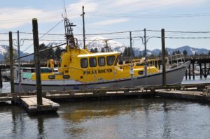 We also met MV Polar Bound! John was ecstatic when he saw that boat at the dock – bright yellow, it’s impossible to miss!
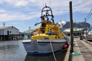 We enjoyed the company of David and June, he is quite a famous British polar explorer having been the first to navigate many or the routes through the Northwest Passage.
May 25, 2013
LATITUDE: 56-59.29N/LONGITUDE: 132-48.58W
COURSE: 346T;SPEED: 5.7
Leaving Thomas Bay after a beautiful respite among mountains and glaciers and a super low, low tide!
 May 25, 2013
LATITUDE: 56-59.18N/LONGITUDE: 133-18.67W
Portage Bay Anchorage after a day of fishing
John caught a halibut and I caught a lingcod!! We went out early this morning with low tide and made our way up the coastline trying several different spots. Turned out to be a gorgeous day and the vista out over the glaciered mountains of the Le Conte Glacial Field across from Petersburg was quite spectacular. At time we had glassy calm waters – hopefully a few of the photos John took will turn out. Our fish were not large, but we’ll have several meals out of them – starting with fresh halibut tonight!! Now it’s GTs/whiskey in the cockpit under sunny skies, light chilly winds and lovely views. Wish we could share with you all. Tomorrow we’ll go try to get a bigger fish and then head on around to Security Bay (about 60miles)
 May 26, 2013 – FISHING!!
LATITUDE: 57-03.41N/LONGITUDE: 133-32.27W
COURSE: 299T;SPEED: 7.2
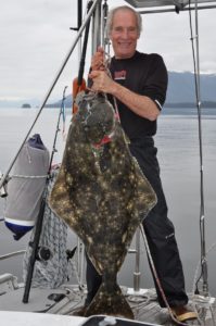
Just finished catching a big halibut!! Quite a FISH FIGHT X2 !!
John caught a big halibut this morning – 70lbs of great eating, but boy did it put up a fight. We got it up to the boat where John hooked it with the gaff, but it put up such a struggle, it nearly pulled him in the water and shook itself off! Away it went with hooks still attached – I grabbed the rod and managed to eventually bring it back up to the boat where John hooked it with the gaff again only to have it go ballistic and tear off again! By this time we and the fish were all bloody. Fortunately it was STILL hooked and although the rod and line were a bit tangled, we managed to keep it and bring the fish back for a third attempt at safely landing it up on the boat. Now we have LOTS of fresh halibut packaged up in the freezer, the boat and galley cleaned up, ourselves all showered and are on our way to Security Bay on the west coast of Kuiu Island. Guess what we’ll be eating for dinner!?
The story of the halibut that got away….
before John hooked his I had hooked what must have been a really big one because after much work trying to bring it up from the depths the fish took off with such vigor it nearly pulled me out of the boat, hanging on to the rod I was horrified to look down and realize that the dang thing was paying out all of my line…when it came to the end it just snapped sending me careening backwards into John and the line slack. John’s first comment was, “oh good, I’m sorry, but I was really getting worried about how the heck I was ever going to gaff that one and get it on the boat!” Seeing the struggles we then had with the next fish, I have to agree with John that it’s just as well the really big one got away. I figure it must have been about 200-250+lbs by the size I saw before it took off and the strength of it’s get-a-way!
 May 26, 2013 -Anchored
LATITUDE: 56-50.23N/LONGITUDE: 134-19.35W
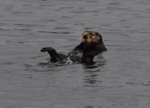
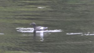
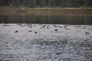
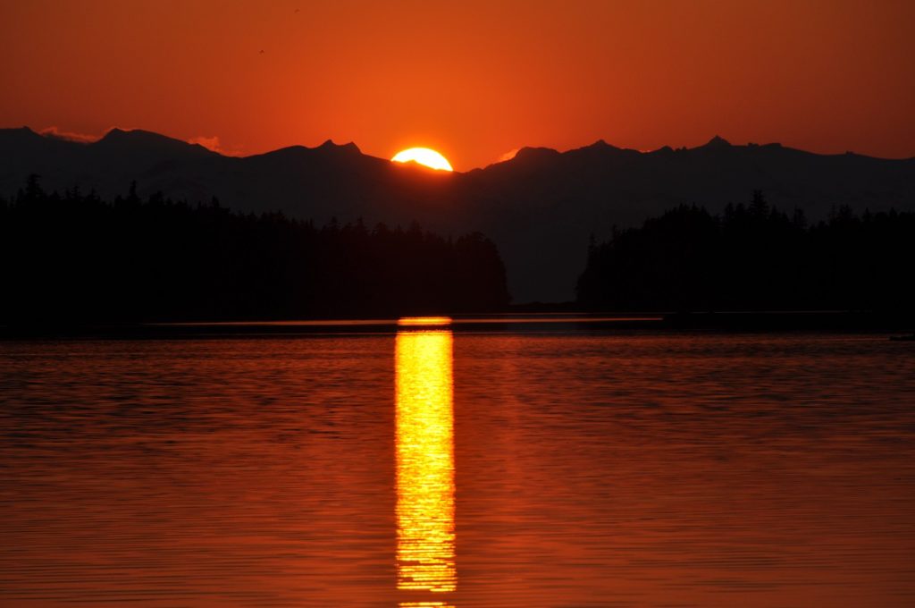
Security Bay watching 50 otters as the sun sets
May 27, 2013
LATITUDE: 56-51.50N/LONGITUDE: 134-32.18W
COURSE: 256T;SPEED: 6.5
On route to Red Bluff Bay
The halibut events were quite exciting – our backs are reminding us this morning of yesterday’s follies! 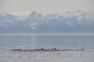 What a long full day we had: scenic beauty and exciting fishing. It’s great to be back in Alaska:) – gorgeous sunny day again!

RED BLUFF BAY, E. Baranof Island May 27, 2013
LATITUDE: 56-52.30N/LONGITUDE: 134-47.11W
Red Bluff Bay -snowy peaks, waterfalls, 2 brown bears, sun and blue skies!
Red Bluff Bay is absolutely stunning, especially in this pristine weather. 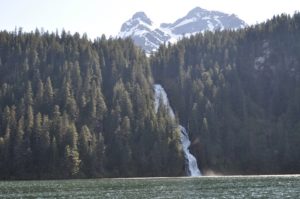 All was perfect until the “Alaskan Story” a luxury boat charter came into the bay and anchored just in front of our view! Oh well. Lots of bears, first a mother and two cubs, then what looked like two young male juveniles who spooked away the mom w/ cubs and then half-heartily followed their trail. Later in the evening a couple more bears were in the meadows.
  We’ve really enjoyed our time here and since we arrived at about 2pm, we had ample time to watch the bears and explore around in our dingy.
May 28, 2013
LATITUDE: 57-11.89N/LONGITUDE: 134-50.92W
Ell Bay – lots of big charter boats everywhere now.
 May 29, 2013
LATITUDE: 57-26.15N/LONGITUDE: 135-36.45W
Anchored in Deep Inlet. Waiting tides in Sergius Narrows.
We can tell that we’re close to Sitka – it’s raining!?!? We’re now on the last leg, stopped in Deep Inlet due to rainy weather and strong tides in Sergius Narrows. Will overnight and finish the trip tomorrow. I am SO thankful for the warm, cozy heater that John installed:) Sourdough bread is in the oven and it’s halibut w/ broccoli for dinner.
 May 30, 2013
LATITUDE: 57-26.15N/LONGITUDE: 135-36.44W
Magoun Islands. Anchored to explore before going to Sitka.
SITKA, ALASKA: with trips to Kruzof Island and Chichagof Island
May 31, 2013
LATITUDE: 57-03.53N/LONGITUDE: 135-21.26W
Sitka – Eliason Harbor 3-6
Lots of work to be done here before we can continue cruising to more beautiful places. I’ll enjoy seeing my friends and hopefully taking some time for walks, runs and hikes around beautiful Sitka.
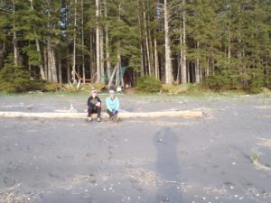
Jodie comes up for a backpacking trip to Shelikof Beach cabin on Kruzof Island
July 23, 2013 – Left Sitka and are headed to the west coast of Chichagoff Island
 LATITUDE: 57-17.25N/LONGITUDE: 135-35.15W
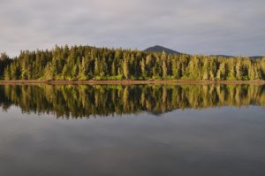
Calm and peaceful morning in St John Baptist Bay
July 24, 2013
LATITUDE: 57-31.25N/LONGITUDE: 135-57.13W
Just left Waterfall Bay where we’d hoped to stay, but we could not anchor because the deep waters suddenly silted up and became too shallow now! Not a safe spot for a boat the size of Raynad.
July 24, 2013- continued LATITUDE: 57-38.78N/LONGITUDE: 136-05.35W Klag Bay
We had an adventurous day yesterday making our way up the coastline of Chichagof, first through Piehle Passage which was a winding course through rocks and narrow/shallow places – a bit scary but also very beautiful and since the ocean swells were quite settled, a good shortcut into Slocum Arm. We tried to anchor in Waterfall Bay only to find that the chart was totally off and the bottom suddenly came up to 0 when it should have been 7-9 meters!?!!? Nothing was as it should be, so we backed out and came on through “The Gate” into Klag Bay. This is where an old gold mining operation dug up over $13mill worth of gold back in 1905-1930. We’ve decided to explore around here today and then head up to Kimsham Bay which is another winding course up around the fjords of Chichagof. It’s beautiful here and so relaxing to be out of Sitka and back in our home on the boat. Two superyachts are also anchored here, we look quite small in comparison. One of them even has a helicopter!
 July 25, 2013
LATITUDE: 57-38.79N/LONGITUDE: 136-05.37W
Kimshan Bay – rainy AM-sun at high tide for our PM 10 mile passage!!
We continued winding our way up through the west coast of Chichagof yesterday. It was raining and low clouds for most of the day, however, just at about high tide it started to clear so we decided to motor up to Kimshan Bay. We had to do this at high tide because of the rocky, narrow passages. A bit of a challenge and at one point even our Alaska/USA charts showed the boat tracking over the island!! It’s almost like navigating in the South Pacific where our charts were up to 1-2 miles off! More challenging here thought because the water is dark and it’s tough to see any underwater obstructions. John investigated this discrepancy and found out that our charts for this area are from NOAA data from 1900-1930, so no surprise the accuracy is questionable. Nothing like rocks in unexpected places to raise the heart-rate! It’s really pretty here though with lots and lots of islands, some great pods of sea lions feasting on the salmon which are jumping around everywhere (mostly pinks) and the very large sea otter floating around on their backs peacefully watching the world go by. The sky is still overcast, but the clouds have lifted. It’s low, low tide now so we’ll wait a bit before leaving and making our next passage.
July 26, 2013
LATITUDE: 57-41.33N/LONGITUDE: 136-06.60W
Baker Bay near Goulding Bay West Chichagof
 July 27,2013
LATITUDE: 57-10.14N/LONGITUDE: 135-46.81W
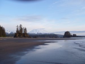
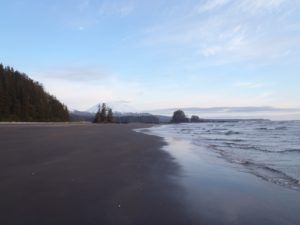
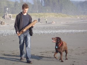
Beautiful Shelikof Bay and a late vist to Nikki on the beach

We made the outside trip down through the islets off the west coast of Chichagof, straight past Salisbury Sound and down along the west coast of Kruzof Island passing the sandy beaches of Sea Lion Cove and some huge sand dunes just south of their. We were on a face with two fishing boats to get the best cove for anchoring, but they won (faster boats!!) leaving us to anchor in the larger cove behind some rocky islets. We were soon joined by 2+ other fishing boats. Launching the skiff, we zoomed our way across the waters only to come up short when we reached the beaches of the south beach cabin area of Shelikof. Even with the rather calm waters, there were some pretty impressive breakers on the beach and the river outlet we’d planned to motor up was one of the worst areas, clearly some decent sand bars were obstructing the entrance. Not one to give up easily, John motored the dingy down the coastline and after several aborted attempts, we were able to land on the beach just around the corner from Port Mary and straight out from the grassy knoll where Nikki’s ashes are. We visited her tree, shed a few tears, and remembered happy times here with Jodie, Scott, Nikki and Taz:) We miss you guys. On the trip back, we toured the north side of “Jodie’s Island” and the 3-clefts are truly impressive. It’s a very unique place. We enjoyed a late dinner of leftover pizza and pasta with a great Trader Joe’s bottle of Shiraz, then slept away with the boat rocking back and forth in the swell. Off to explore the other bays a bit this morning before heading back to Sitka.
Oregon Seaside Visit with Scott- July 2013
**CRUISING BREAK***
sv Raynad was all provisioned and ready to sail southward to warmer waters, however, Kristy had applied for some teaching jobs in Alaska and a last minute phone call changed everything.Work starts in Haines, AK on August 14th, so Raynad is super packed and moving us up to a rental home in Haines. Kristy will be teaching music, band and choir, for grades 5-12.
August 9, 2013
LATITUDE: 57-51.75N/LONGITUDE: 135-03.00W
 Cedar Cove in Freshwater Bay after 12 hr 90mi day!
We arose at 5am and were out of the harbor by 5:30. Twelve hours and 90 miles later we are roughly half-way to Haines! Now we’ll relax a bit and enjoy the weekend which is forecast to be sunny and warm:) Let’s hope it’s right. We have to cross Icy Strait tomorrow, but otherwise it’s just up Lynn Canal amongst the green glacial water. Today brought us speeds through Sergius Narrows of up to 13kts!! We actually averaged nearly 8 for the full trip which is really good for this boat and the amazing tidal variations that we passed through. I really love the squiggly inside routes which give such beauty and variety to the experience. While we were going 9kts with only 1000rpms (half or less power,) we passed two small fishing boats struggling against the tide and barely managing 0.5 kts – they were nearly getting knocked backwards. Really frightening for them, I’m sure, but a bit unsettling for us as we had to pass them port to port through the most narrow bits while they slooshed and sloshed against the tide!?! Pretty amazing. Now happy hour is happening followed by a maple salmon dinner and then long sleep (we hope:)
August 10, 2013
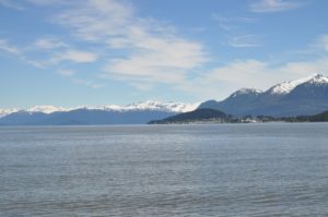
LATITUDE: 58-37.80N/LONGITUDE: 135-09.87W
Anchored in Lynn Canal with glacier vistas and sunset.
We had a much slower day yesterday with the various winds and tides not helping us at all with speeding along up Chatham Strait. Being a clear, sunny day with vistas of distant towering mountains and cliffs, it was very pleasant and relaxing. Nice to have the diesel and motor power to make our way without winds to sail. Today is another stunner! Absolutely cloudless skies. We came into Boat Harbor last night at high tide through a very narrow and winding entrance in the rock(a sort of hole in the wall,) so now we must wait for the tide to change a bit more before it’s safe to exit this morning. During the tide changes, the entrance sounds like a roaring river! The tide here fluctuates by 15+ feet so even though we had 21 feet under our keel coming in last night, that doesn’t leave us enough clearance for our 8 foot draft at low tide. Darn! We’ll just have to linger and enjoy the quiet solitude of this bowl-like bay:) The boring name doesn’t do it justice, although it is very protected and would a welcome relief to be safely “harbored” in here while the storms rage outside. Chatham has a fierce reputation, so we’re very lucky to have such great weather for our trip. We have about 48 miles to go, but will likely spread that out a bit to arrive Monday morning.
August 11, 2013
LATITUDE: 58-37.78N/LONGITUDE: 135-09.88W
Sullivan Island Arm anchored with 360 degree views of craggy mountains reflected in calm waters – really stunning! Who wants to rush? We’ll linger here a couple of nights and then make our way into Haines the night before work starts.
 HAINES, ALASKA (August 2013 to May 2014)
I’m now teaching 4-12th grade music in Haines, Alaska!! I have 4 bands, 2 choirs and 2 general music classes – a pretty heavy load with lots of challenges. Just survived the first week! I was a late hire, being contacted only 2 weeks before the start of teacher in-service. After taking the ferry from Sitka to Haines to look over the job, we rushed back to Sitka, loaded up the good ship Raynad and had a beautiful, leisurely 5-day trip up here. It’s been a fantastic summer. We’re lucky to have chosen this summer for some SE Alaska cruising. Looks like we’ll spend next summer around SE Alaska as well.
August 31, 2013
LATITUDE: 58-55.64N/LONGITUDE: 135-22.10W
SV Raynad-Back out west of Sullivan Island for a relaxing weekend
We’ve had a totally relaxing day waking up in the fog and slowly watching the winds and waves build. A good excuse to read and enjoy things like pecan pancakes and many cups of tea!! Now it’s a calm, misty evening after steaks, salad and wine and we’re enjoying the view of bears fishing at the estuary amongst the misty mountains. It’s a perfectly wonderful evening together.

We’ve been warned of the harshly cold winters in Haines. John is a bit reluctant to keep the boat in the harbor and yet it’s much easier to do that than to be away somewhere else. It’s really been nice to have the boat and the ability to get away this weekend. If it stays here in Haines, we might get some chances to get away during the winter. 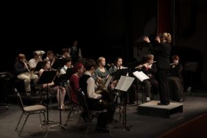 Nothing like time taken away to appreciate this simple, carefree moments. Nonetheless, the zero and minus temps predicted for the winter may really drive us to move the boat southward. In the meantime…it’s been great to have the time together.